
SeAL- Capable Ground Control Station for Sea, Air, and Land Unmanned Systems. Designed to enhance operator awareness across unmanned systems in challenging environments, delivering a clear digital picture of the operational area.

MAIN FEATURES
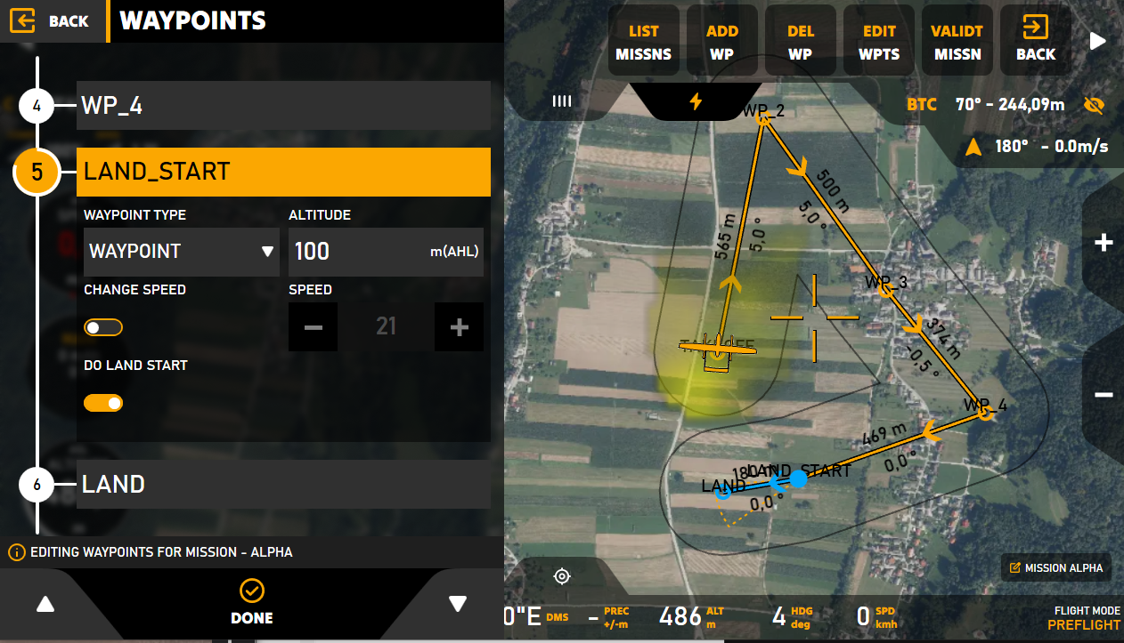
Advanced mission planning tools for diverse operations
Seamlessly manage UAVs, UGVs, and AUVs
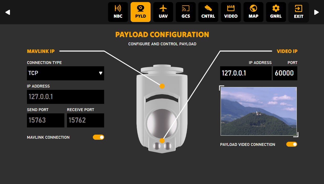
ISR, CBRN sensor, and other payloads available
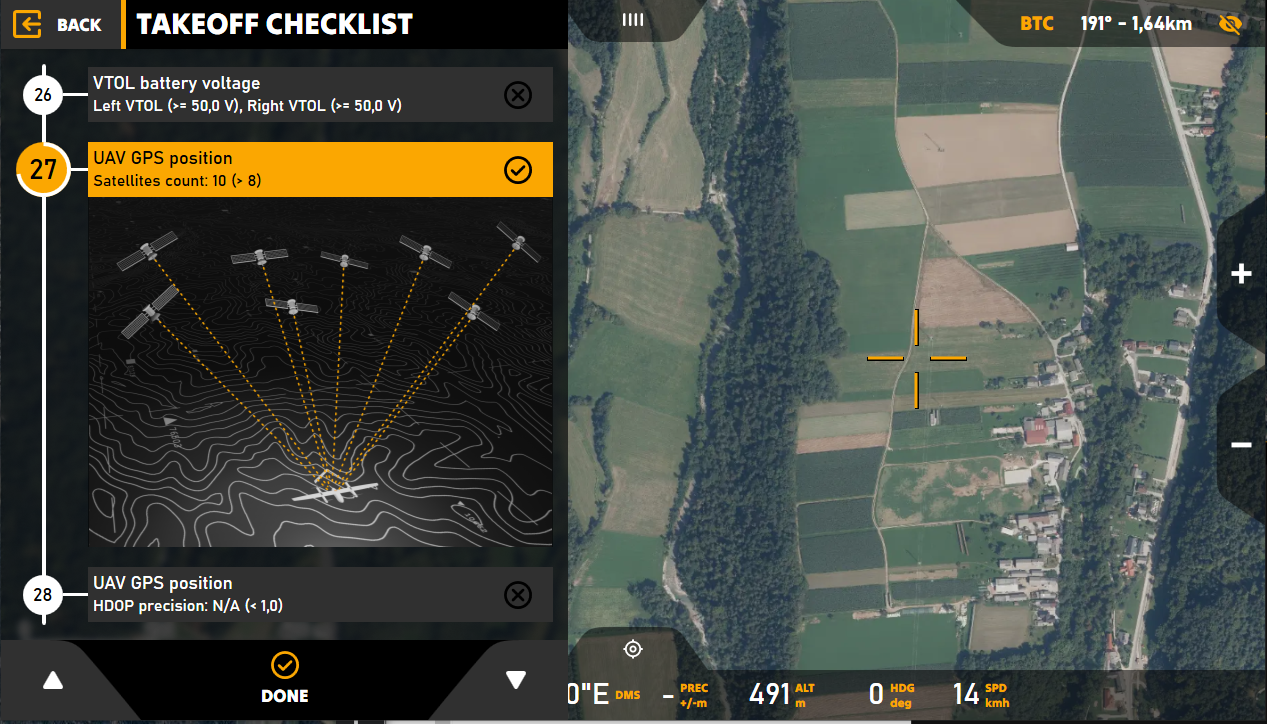
Multiple checklist templates to streamline operational procedures
Integrates inertial sensors, communications, and weapon systems (government clients only)
High-quality video recording, and live streaming capabilities of geo referenced video
Utilizes artificial intelligence to optimize operator efficiency and mission effectiveness
Enables coordinated operations of unmanned vehicle swarms
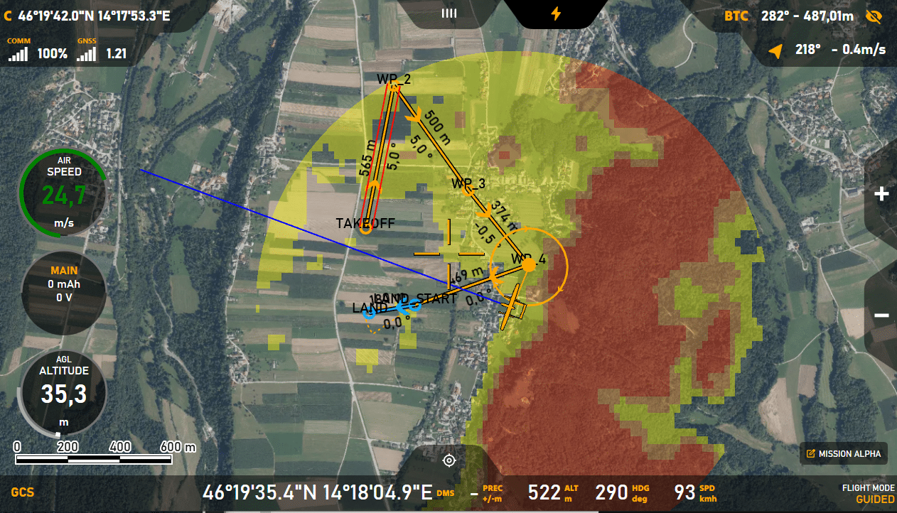
Terrain warnings
The terrain warning is a graphical feature that allows the user to easily identify areas where the terrain is too high for the UAV’s current altitude.
Thunder-GCS is an integral component of the Mil Sistemika C4I suite, working seamlessly with STORM for mission planning and LIGHTNING for on-the-ground tactical operations. The integration of these systems ensures that all levels of command—from individual soldiers to entire platoons—are synchronized and empowered with real-time intelligence, ensuring rapid, coordinated decision-making.
Storm
Top-tier mission planning tool for military operations, providing advanced symbology, mapping, mission planning, and real-time data visualization to keep operators and command staff fully informed.
Thunder
A state-of-the-art GIS based battlefield management and fire control system designed for operation planning, facilitating intelligence collection, distribution, and the coordination of various unmanned systems, including sensors and payloads.
Lightning
A lightweight solution designed for dismounted soldiers, ensuring smooth integration with Thunder and Storm systems for real-time communication and situational awareness at the tactical level.
C4I Bridge
A crucial interface that integrates diverse C4I systems into a unified network, enhancing collaborative operational capabilities from individual soldiers to larger formations.
Thunder GCS is extensible, allowing operators to enhance their
system as the requirements grow:
RESTREAMER Module
Facilitates efficient video stream storage, viewing, and sharing across networks, optimizing bandwidth management for streaming multiple low/high quality videos on-demand to prevent communication congestion in critical environments
SPECIAL PAYLOADS Module
Integrates tools for CBRN detection and advanced weapon systems (exclusive for government clients)
WIZZO AI Module
Artificial intelligence integration that assists operators in object recognition and reduces workload by identifying potential targets or hazards
WING COMMANDER Module
Enables advanced drone swarm management, supporting aerial, ground, water, and underwater operations
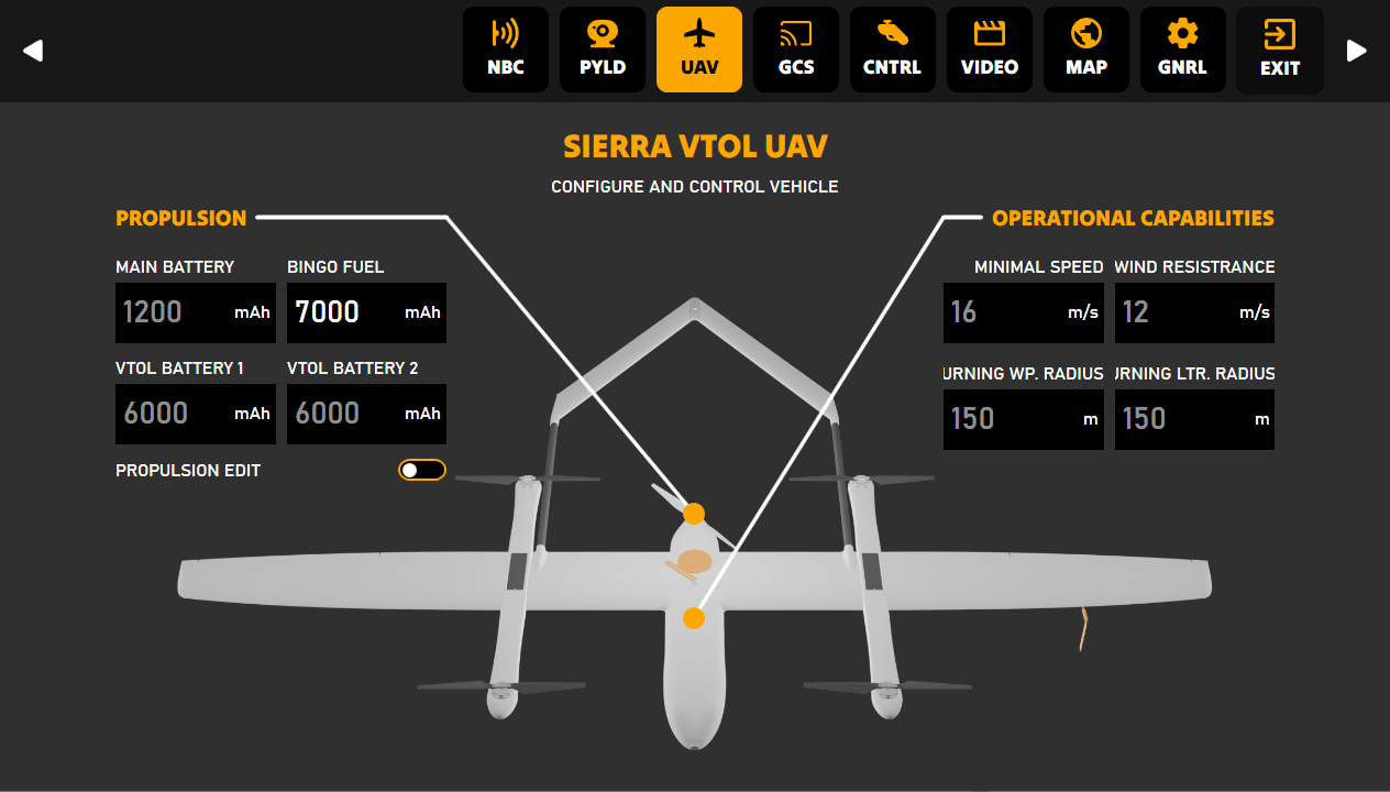
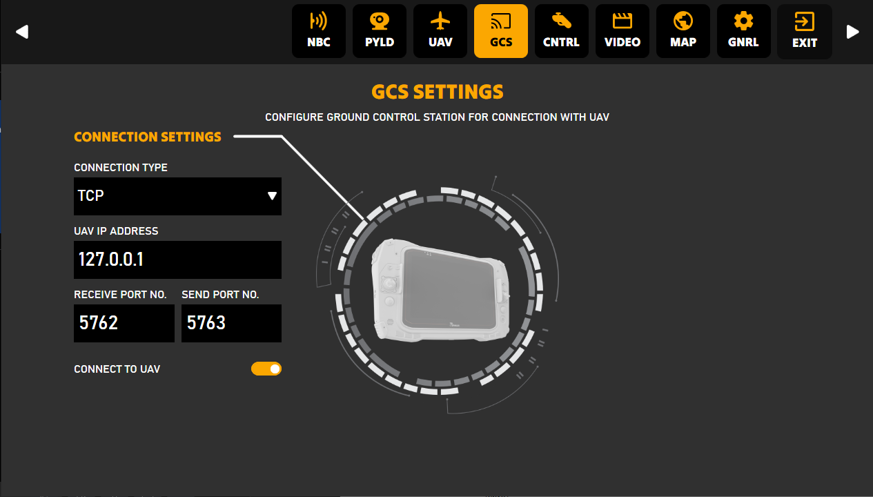
UxV Settings
UAV, UGV, Or UAS Type specific settings can be configured
through graphical user interface. Users can view, set or verify
important information such as battery status, minimal speed, wind
resistance, and other key performance metrics.
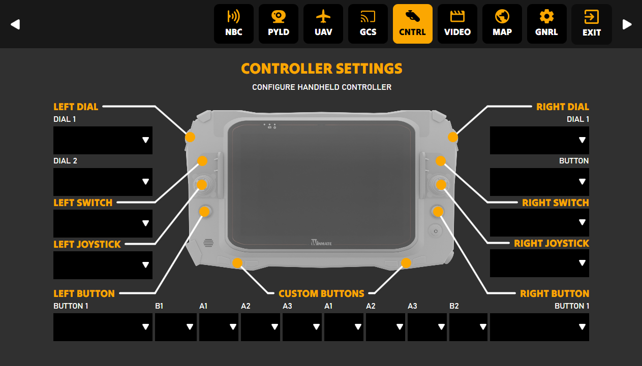
Controller Settings
Thunder GCS will automatically recognize attached controllers.
Operator can assign and test functions to the buttons, switches,
and joysticks based on the drone’s specifications and the mission
requirements, ensuring optimal performance.
Thunder GCS is available in four configurations. Small (S), Medium (M), Large (L), and ExtraLarge (XL) – to cater to different operational requirements and budgets.
Small (S)
Entry-level configuration for users with basic operational needs, ideal for minimizing the risk of UxV damage
Medium (M)
Offers a balanced feature set for more experienced operators
Large (L) & Extra-Large (XL)
Advanced configurations with extensive customization options, requiring trained operators due to the higher complexity of mission planning and execution

With its true GIS-based architecture, Thunder-GCS offers unparalleled flexibility and adaptability, ensuring seamless command and control of unmanned aerial, land, water, and underwater systems.

Mission: Madagascar Collaboration with UNFPA
Using modern technology to address critical humanitarian challenges.